As you know, you can accurately determine any location on Earth using a combination of latitude and longitude. And it would be really strange if the most popular map service didn’t have a function to view the coordinates of the area.
You’re probably used to quickly finding landmarks, restaurants, and routes that meet your needs with just a few clicks on Google Maps. However, if you want to map a place that isn’t already marked, you need to get the GPS coordinates of that location.
Google Maps is the most efficient and accurate way to get coordinates. So let’s take a closer look at how it works.
How to get GPS coordinates for a location on Google Maps mobile app
If you want to get GPS coordinates for a place on Google Maps using your iPhone, you can follow these steps:
- Open the Google Maps app on your mobile device.
- Then tap and hold an unmarked spot on the map. You can use your fingers to zoom in on the map and avoid other pins.
- A red pin will appear at the touch point.
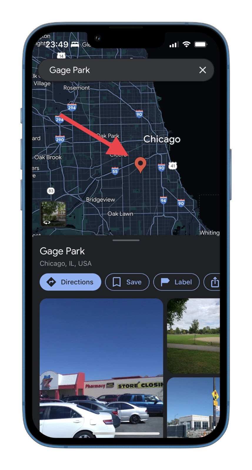
- Swipe up from the bottom to display the longitude and latitude of the selected location.
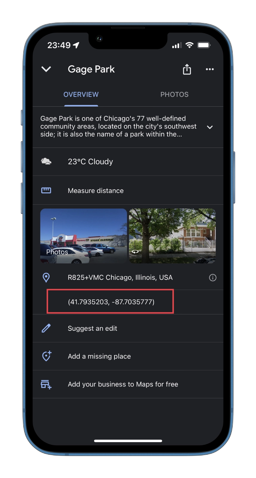
- You can save these coordinates to the clipboard by tapping on them. You can send them to anyone you want by pasting them into the messenger app.
- You can also quickly share a location by swiping to the right in the menu at the top. Just tap on the Share option.
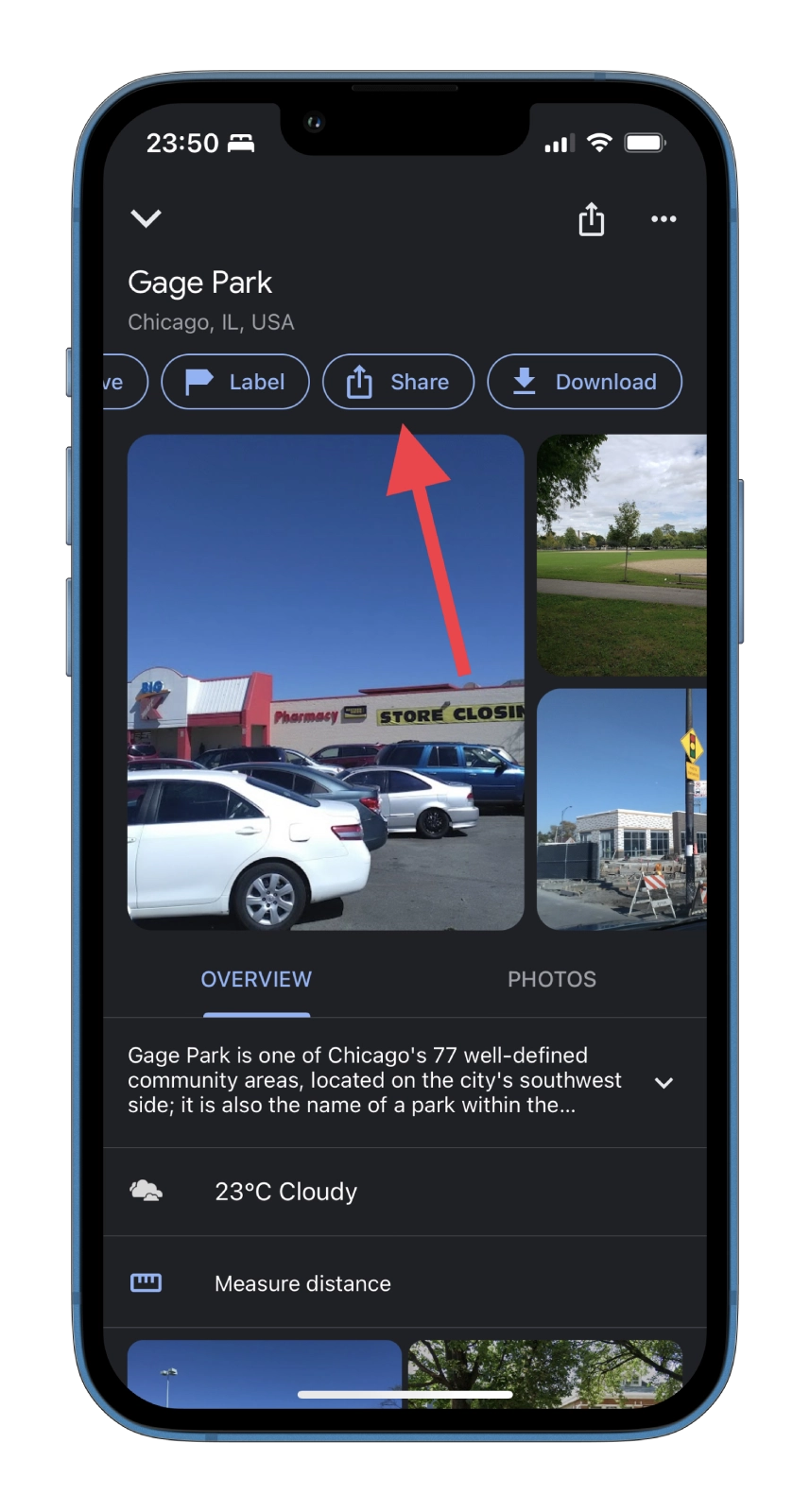
Once you have completed these steps, you will get GPS coordinates for your chosen location on Google Maps.
How to get GPS coordinates for a location on the Google Maps website
If you want to get GPS coordinates for a location on Google Maps using a web browser on your PC, you have to follow these steps:
- Open your web browser and go to the Google Maps website.
- After that, go to the location you want the coordinates of. Use the mouse wheel to zoom in and out.
- Right-click on the place you want.
- In the drop-down list, you will see your coordinates.
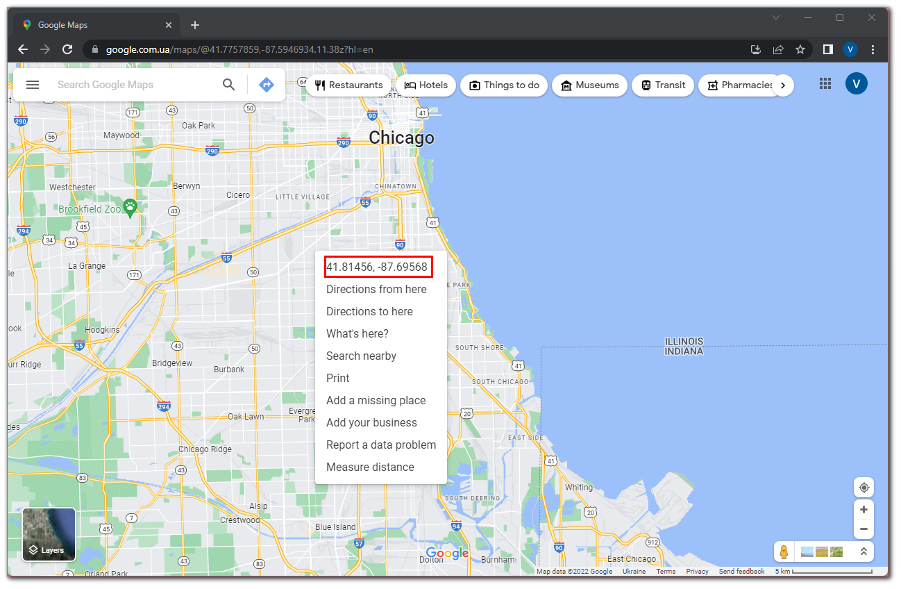
If you want to copy these coordinates, just click on them. That’s it. As you can see, there’s really nothing complicated about getting GPS coordinates on Google Maps.
How accurate are the GPS coordinates obtained from Google Maps?
Google takes images from different sources and combines them into Google Maps. According to Google itself, the accuracy is at least 15 meters.
Considering that 15 meters can be a lot, scientific studies were conducted to verify and correct these claims. They concluded that the offset could be anywhere from 1.5 to 9 meters, depending on the studied area.
More images are available in cities, and Google updates its maps in urban centers more often than in rural areas. However, tall buildings and signal interference can cause more GPS location drift in densely populated areas.
What else should you know about GPS coordinates?
Latitude is divided by 180 degrees. The equator is located at latitude 0 degrees. The north pole is at 90 degrees, and the south is at a latitude of 90 degrees.
The longitude is divided by 360 degrees. The prime meridian, located in Greenwich, England, has a longitude of 0 degrees. From this point, the distance is measured East and West, extending 180 degrees East and -180 degrees West.
Minutes and seconds are smaller increments of degrees. They allow you to get more accurate coordinates. Each degree is equal to 60 minutes, and each minute can be divided by 60 seconds. Minutes are indicated by an apostrophe (‘) and seconds by double quotation marks (“).

